Most of the time, that first look out of the window after getting up will tell you all you need to know – rain, snow or a bright blue sky? In everyday life, we can usually judge the weather well. And if an unexpected shower does show up, the nearest café will provide a cosy and dry retreat. At altitude, however, it's a different story: the weather in the mountains can change quickly and often unexpectedly. And if there's no shelter in the immediate vicinity, it becomes unpleasant.
But how can you even tell if a thunderstorm is on the way? What do storm clouds look like? And what's the best way to prepare yourself for a possible change in weather? Today we're going to talk about clouds, the weather and thunderstorms in the mountains.

Planning to a T.
… that also applies to a trip to the Nockberge mountains. The following tips will help you prepare for your next mountain adventure:
1. Weather check.
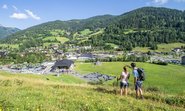
Before setting out, you should check the current weather forecast in the hiking and biking area. You can also take a peek at one of our 11 webcams to help you better assess the current situation on site.
Extra tip: You can check out the Bergfex app and website for a detailed overview of the weather, wind and precipitation levels. Please keep in mind that this is also just a prediction. So never rely 100% on the weather forecast...
2. Pack the right clothes.
You should always pack a rain or wind jacket and a long-sleeved top in your backpack. They'll keep you warm and dry even at higher and therefore cooler levels of the Nockberge mountains.
3. Plan your route carefully.
Especially for longer hiking tours, it makes sense to take a closer look at the routing beforehand. Memorise the important points, such as lift stations, refuges or forks in the trail, so that you can react more quickly if there's an emergency. Thunderstorms often start brewing during the day. Ideally, you'll start your hike in the morning.

If clouds could speak…
It is always advisable to look at the sky. But it's not that easy to interpret the cloud formations and changes in the weather correctly. We have summarised a few examples of different weather signals for you here:
1. Signs of fair weather.
A cloudless, blue sky is a good sign for a clear day in the Nockberge mountains. Even if there happens to be small fleecy clouds, the weather normally remains stable – as long as they don't merge into larger cumulus clouds. If there's more fog in the valley in autumn, you can often look forward to bright sunshine above the fog line.


2. Signs of bad weather.
If the sky darkens and large thunderclouds in the shape of anvils form, you can get rain, lightning and hail at any time. And large cumulus clouds are also a relatively sure sign of an impending thunderstorm.
If you see cloud towers on the windward side of a mountain, but nearly cloudless skies on the downwind side, this is called a foehn wall. This means heavy rainfall is heading your way. You should also keep an eye out for banner clouds on the downwind side of the peak. If it gets bigger, then the weather usually gets worse
If a wall of clouds starts rolling towards you, this is probably a cold front. This announces itself with cold, gusty winds and brings cool, heavy rain and thunderstorms. A thin, bluish-grey stratus cloud moving in front of the sun means it will soon rain.


What types of thunderstorms are there?
Generally speaking, we can differentiate between frontal and thermal thunderstorms. Frontal thunderstorms usually occur over large areas in conjunction with a cold front, regardless of the time of day or season. Thermal thunderstorms, on the other hand, form more frequently during the hot summer months. During a period of good weather, the risk of thunderstorms increases each day until at some point it literally 'cracks'. In the Alpine region, July is considered the month with the most thunderstorms.
What are the signs a thunderstorm is coming?
- How. A thundercloud is very powerful and up to 13 kilometres in height. If this is accompanied by gusty fresh wind and an electric whirring sound, it's a clear sign of an approaching thunderstorm.
- When. A thunderstorm can develop from an ordinary cumulus cloud within just 45 minutes. Warm, moist air and stronger wind conditions in particular are what's driving this.
- What. We always advise caution when the clouds are gathering! Gale-force winds, heavy rain and hail cannot be ruled out. A light yellowish haze in the cloud tower is a clear sign of hail.
- Why. How dark a thundercloud is depends on how much water it holds and how much it absorbs sunlight. The less sunlight that comes through the cloud, the darker it appears. Therefore, black clouds indicate a strong thunderstorm.
- Where. Sound and light move through the air at different speeds. As a result, it is quite easy to calculate how far away a thunderstorm is. Just count the seconds between lightning and thunder and divide this number by three. This gives you the approximate distance of the thunderstorm in kilometres.

By the way: With prevailing Mediterranean lows, you can expect thunderstorms to increase soon afterwards in the southern Alpine region - and accordingly also in Carinthia.
What should I do during a thunderstorm on the mountain?
No matter how well prepared you are, the weather can still change at short notice.
If a thunderstorm catches you off guard on the mountain, take the following action:
- Leave exposed slopes, summit crosses and rock towers as soon as possible.
- Find a nearby retreat, such as a hut or summit station.
- If there's nowhere to stop: sit on your backpack in a squatting position with your feet together (so-called crouching position) and wait for the thunderstorm to pass. The smaller your direct contact area with the ground, the better. Due to the risk of falling rocks, you should also keep at least 1.5 metres away from rock faces. Place metal equipment (for example, walking sticks) a good distance away from you.
Important: A mountain bike is not a Faraday cage. Although your bike's tyres are made of rubber, the huge metal box around them will not protect you from lightning. So if a thunderstorm happens, stop cycling immediately and keep at least three metres away from your bike.
It's even more important that you stay calm and don't panic.


Safety first – also for mountain railways.
If a thunderstorm is approaching, there are clear legal safety regulations that govern the operation of our cable cars. An ongoing cable car journey must therefore be completed with special care - the so-called 'empty run'. If there are still people in the cable car at this time, we transport them to the valley station. Afterwards, the cable car will stop operating as long as there is any danger from the thunderstorm.
For the two sections of the Kaiserburgbahn, this process takes about 30 minutes. It is therefore particularly important for our cable car team to interpret the weather signs at an early stage and react accordingly. The operations managers of our two summer cable cars also decide individually for each lift whether or not they have to interrupt their operations because of a thunderstorm.
Note: During a thunderstorm you are always safe in the cable car cabin. This is because lightning is generally conducted into the ground by the station buildings and the cable. The cabin itself - just like a car - acts as a Faraday cage and conducts the current away via the outer shell.
Enough of thunderstorms? If the weather turns bad during your holiday, rather relax in the cosily warm Thermal Römerbad with a fantastic view of the Nockberge mountains. And the great variety of offers around the Bad Kleinkirchheimer Bergbahnen also has a few bad weather options. Take a look at our website for inspiration.